Very Low Frequency – Electromagnetic or VLF-EM surveying is a geophysical technique using very low frequency radio transmissions. The continuous, high power, low frequency electromagnetic transmission ranges from 3 kHz to 24 kHz. When the waves come in contact with a conductive material in the subsurface, they generate a secondary magnetic field around it.
These instruments measure number of different frequencies in sequence to ensure that the secondary magnetic field is of the highest signal strength. Once these conductors are found, the survey will measure the orientation, tilt-angle and/or dip-angle, of both primary and secondary fields to determine its position.
As the instrument passes perpendicular over a conductive material that is standing vertical, the orientation will change from a maximum on one side and a minimum on the other. This point, where it changes from positive to negative is called the ‘crossover point' and is directly at the top of the conductor. If the conductive material dips, then the shape of the field will be distorted to be either positive or negative.
Once a survey is completed, the data acquired normally consists of three parameters relating to the secondary field. These three parameters include; the amplitude of the field, its quadrature and in-phase components in relation to the primary magnetic field. Once examined they are typically presented as profiles of distance.
Further filtering is performed to produce a clearer and well defined location of the crossover point which aids in the interpretation of the anomaly. Even more advanced filtering of the real component provides clearer details and provides clues to the conductive minerals density. This advanced filtering can provide an indication of how concentrated the material is and can provide an approximation of the depth and the location of the mineral.
Additionally, the reverse of a conductive material during a VLF-EM surveying operation can be true. If an object shows a high resistivity to the low frequency, it can provide information of a non-conductive element.
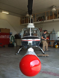
VLF-EM data provides a very unique set of data that can be used to create imagery of the structure and even stratigraphy, where most other types of data cannot. While VLF-EM data is not commonly used in exploration, it is becoming a more attractive option as new technologies emerge. An example of new technology is that of Terraquest Ltd of Markham, ON who is generating a great deal of excitement with its proprietary airborne XDS VLF-EM system which uses three oversized orthogonal coils to map structure from the air. The XDS VLF-EM technology maps fine grain, low conductivity and more disseminated structures providing a more comprehensive database for Geologists trying to sort our geological complexities. Consequently, this technology is suited to mapping structure related to any exploration commodity.
Airborne VLF-EM data is gathered with three different coils on the x, y, and z axes. Presenting the data on three separate maps produces much cleaner structural profiles compared to a single amalgamated data. XDS VLF-EM acquires data in a broadband mode (typically 22-26 khz) and thus it is not sensitive to geological strike and the availability of a particular transmitter.