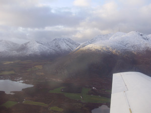
Geophysical companies conduct efficient geophysical
explorations for governments, individuals, mapping professionals, mining
companies and others who are in the field of geophysics and who depend upon
geoscientific data. The exploration of geophysics involves acquiring data from
a specific terrain in terms of the mineral qualities present in the Earth's
crust. Data that can be uncovered applying the use of geophysical exploration
are the concentration levels of the following commodities in specific areas:
-
Minable magnetic ores
-
Petroleum
-
Carbon
-
Underground reservoirs
-
Hydrocarbons
-
Uranium
-
Base and Precious Metals
Efficient geophysical explorations employ the use of precise
data acquisition systems in order to ensure that the data obtained during an
exploration is highly precise and dependable should it be the instigating
factor in a costly mineral exploration.
The majority of geophysical explorations are conducted using
airborne methods and as such, can be a large financial investment. Therefore,
governments and mining companies often choose to conduct their explorations
with geophysical companies who specialize in conducting airborne geophysical
surveys.
A professional geophysical company will be able to offer the
use of highly developed data acquisition systems and conduct airborne magnetic,
electromagnetic and gamma spectrometry surveys.
Unlike using a standard aircraft to conduct an airborne
geophysical survey, an advanced geophysical company will employ the use of a
specially developed aircraft that has been made specifically for the purpose of
conducting airborne surveys.
Geophysical companies are able to offer fixed wing aircrafts
that can conduct high resolution and detailed surveys. Using methods such as
pre-planned drape flying, it is possible to greatly enhance the precision and
quality of the data acquired during an airborne survey. Pre-planned drape
flying allows for consistent line-to-line correlation at intersections of
traverse and tie lines. It also enables the surveyor to comprehend the exact
positioning of the aircraft, leading to better quality data.
Airborne magnetic surveys are the most commonly used
airborne geophysical surveys. There are basically two categories for airborne
magnetic surveys: regional surveys and detailed surveys.
A regional survey will acquire data at a lower resolution
due to a wide traverse line spacing of over 500 meters. This type of
geophysical survey will cover at least 5000 square kilometers and is used a
means of creating maps and developing perspective on the concentration of
nonmetallic resources such as petroleum and coal. A regional survey is
conducted as well for tectonic studies.
As indicated by the name, detailed surveys offer higher
resolution data regarding specific magnetic mineral ores that are present in
the Earth's crust of a particular area. As such, detailed surveys are capable
of providing sufficient data for mining companies, and can act as a means of
prospecting prior to a mineral exploration.
A detailed survey will indicate where there are highly
concentrated areas of magnetic mineral ores, such as magnetic iron ores. These
surveys are also applied as a means of indicating basement targets for
hydrocarbon exploration.
Geophysical exploration companies offer highly effective means
of surveying terrain and mineral prospecting. The sophistication of the data
acquisition systems used, combined with specially developed aircrafts make
geophysical companies a main component in mapping lithology and mineral
prospecting.
As the process of collecting geoscientific data can be
costly, it is important to work with a geophysical company that has a strong
procedure for dealing with factors that can possibly interfere with the relay
of vital data. These factors are referred to as "geological noise” and work to
conceal conductive targets. The following factors can cause geological noise in
a geophysical survey:
-
Serpentinized ultramafics with magnetite bands
-
Metamorphosed country rock with graphite bands
-
The possible lateral variations that can be found in
conductive overburden
-
Existence of clay in rocks or water
Electromagnetic surveys are used to address the above. This
method employs the use of an alternating electric current that is passed
through a sending coil that will cause a magnetic field. An eddy current is
generated when the coil is underground where a second current develops. Here,
the electromagnetic field is measured by an electronic amplifier. As the
receiver and source broach closer to a conductive zone, the eddy current
circulates and intensifies, in turn initiating a secondary current.